A really nice evening with the canoe club taking the little people down the Aberfeldy section of the tay. First time down rapids for most, and some even wanted to swim down them!!!!
Friday, 13 May 2016
Wednesday, 11 May 2016
First Spey
First Spey trip with 8 ladies. Snow at the start sun to finish
The 'Biscuit Barrell'
Snowy start in Aviemore
The sun trying to make an appearance
All cued up ready for the next rapid
Hey there good looking
Crew ready to tackle the 'Knockando' Rapids
Fife Coast
A lovely weekend away down on the Fife Coast. Two brilliant walks, the first at 'Tentsmuir Point' and 'Kinshaldy Beach' then on to the 'St Andrews Coast'
Until it was drained and planted by the Forestry Commission in the 1920's, Tentsmuir was a remote area of desolate salt-marsh, known only to smugglers and fishermen. For thousands of years the sands carried down by the River Tay have been deposited at its mouth, building the shore slowly eastwards in a process of natural land reclamation.
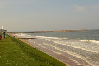
Kinshaldy Beach
Winston, with more space than he knows what to do with!
Tall bench or short legs!?
Just the 3 of us
Yep
The remote beaches of Tentsmuir were considered to be a possible landing point for German invasion during World War II, so a series of lookout towers and anti-tank defences were built.
19th century ice house, where ice was stored during the summer months for use by salmon fishermen netting fishing the waters off the near by beach.
'The March Stone' The stone was erected as a boundary marker for fishing rights in 1794. The term 'March Stone' comes from the 16th century meaning 'March' as a boundary.
Happy little chappy
Van time at St Monans
Fife Coastal Path, This walk explores a lovely stretch of rocky coastline between St Andrews and Boarhills
'Rock and Spindal' sea-stack
Checking out our sun tans
Stunning coastline
Buddo Rock
Breaking waves heading back towards St Andrews
East Sands, St Andrews
watching the sunset with beers in hands
Still working on those tans
Sunset
Content
Subscribe to:
Comments (Atom)


